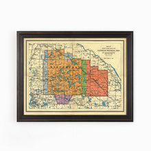
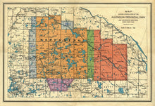
This map tells the story of how Ontario's largest provincial park (at the time) was developed over several decades. The map depicts the various parcels of land that were added over several years by colour coding them. At this point,
Algonquin Park is almost 8000 square kilometers of lakes, streams, rivers, bogs, forests in the rugged Canadian Shield.
(Please refer to FAQ's for more info and pictures.)
- Paper-Hahnemuhle Archival, heavyweight and thick 240g 100% cellulose, warm white art paper with a smooth matte surface. Perfect for framing.
- Canvas-Gallery wrapped using heavyweight 400g, archival canvas. It's protected with a satin varnish, and stretched around a 1.5 inch pine wood frame, ready to hang. (No exterior frame)


