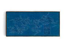
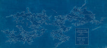
A rare and stunning map of the entire Muskoka Lakes region. Shows incredible detail of the various waterways and navigation channels. Originally developed in 1948 by Gerald R. Leeder of Toronto this is a fantastic example of a blue acetate style map that allows for easy reading. We have restored and optimized this map for printing and mounting using modern technologies.
Because of the high level of detail found in this map, we recommend prints of at least 24" X 50".
(Please refer to FAQ's for more info and pictures.)
- Paper-Hahnemuhle Archival, heavyweight and thick 240g 100% cellulose, warm white art paper with a smooth matte surface. Perfect for framing.
- Canvas-Gallery wrapped using heavyweight 400g, archival canvas. It's protected with a satin varnish, and stretched around a 1.5-inch pine wood frame, ready to hang. (No exterior frame)


