


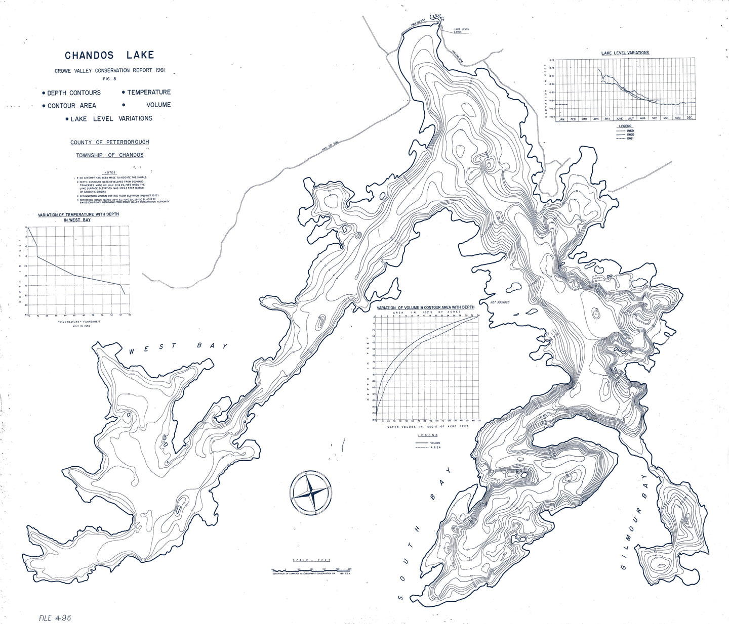
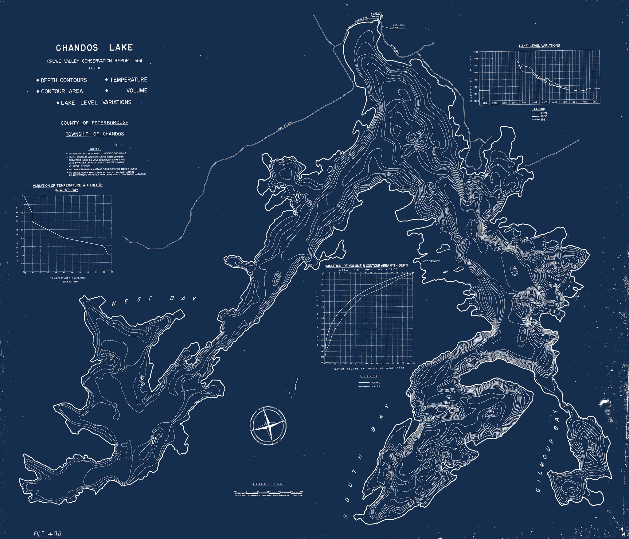


This map of Chandos Lake in the North Kawartha region is from a series of bathymetric maps produced by the Ontario Ministry of Natural Resources. It is dated 1961 and is an excellent example of depth chart maps from this period. We found it to be unique because of additional data, beyond the depth contours of the lake bottom and shoreline, that are displayed on this map. The map includes charts of the Lake Temperature, a depiction of the variation of the contour area, as well as the yearly variation in the water levels of Chandos Lake. If anyone has any back story on why the MNRF took such a keen interest in studying and charting Chandos, we'd love to know!
In the meantime, we've retouched this map to highlight the beauty and simplicity of this original "infographic". We hope you enjoy looking at it as much as we do. The contours of the shoreline and lake depth profile, as well as hand-drawn notes and features, are well captured and add to the allure of the piece.
(Please refer to FAQ's for more info and pictures.)
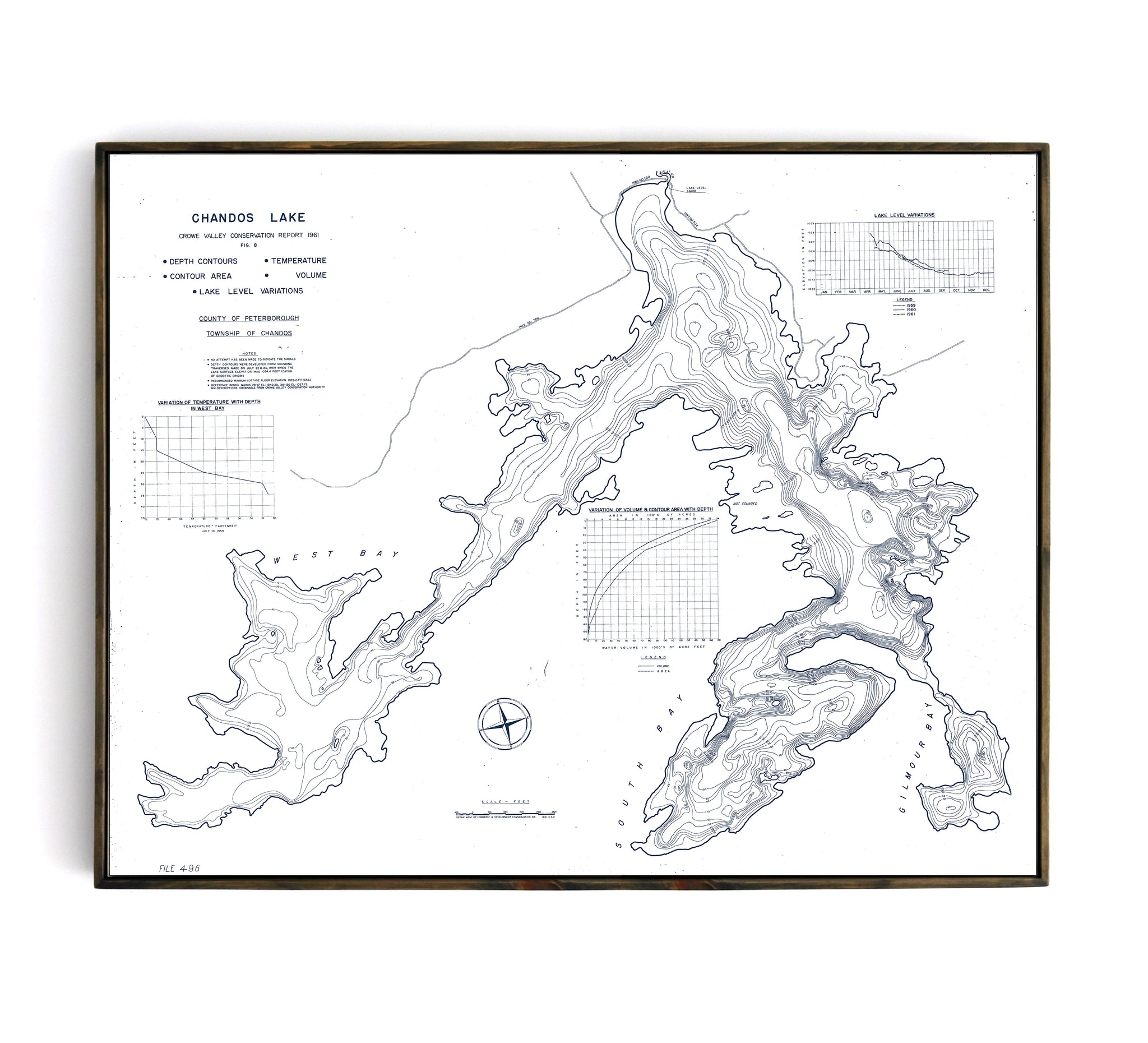
- Paper-Hahnemuhle Archival, heavyweight and thick 240g 100% cellulose, warm white art paper with a smooth matte surface. Perfect for framing.
- Canvas-Gallery wrapped using heavyweight 400g, archival canvas. It's protected with a satin varnish, and stretched around a 1.5 inch pine wood frame, ready to hang. (No exterior frame)