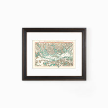
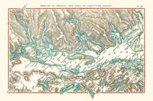
Map of British Columbia from the Straits of Georgia to part of Vancouver Island. Showing bodies of water, and various other landmarks.
The map is from 1873 and was hand-drawn by one of the most famous Canadians to have ever lived: Sir Sandford Fleming was an engineer and inventor. He proposed worldwide standard time zones, designed Canada's first postage stamp, left a huge body of surveying and map making, engineered much of the Intercolonial Railway and the Canadian Pacific Railway, and was a founding member of the Royal Society of Canada and founder of the Royal Canadian Institute, a science organization in Toronto.
(Please refer to FAQ's for more info and pictures.)
- Paper-Hahnemuhle Archival, heavyweight and thick 240g 100% cellulose, warm white art paper with a smooth matte surface. Perfect for framing.
- Canvas-Gallery wrapped using heavyweight 400g, archival canvas. It's protected with a satin varnish, and stretched around a 1.5-inch pine wood frame, ready to hang. (No exterior frame)


