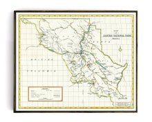
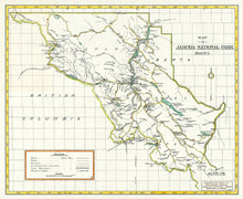
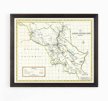
This hand-drawn map of Jasper National Park beautifully details the over 11,000 square kilometers of the rugged, mountainous expanse that is widely considered one of the most beautiful places in Canada. We estimate this map is from the early 1920s and was compiled and drawn by the Engineering Service of the Canadian National Parks Service Department of the Interior.
The original was in excellent preserved condition - this version has minor color correction to showcase the high-level of detail included in the map including various mountain ranges, named peaks & elevation details, numerous lakes, travel routes, and park infrastructure that existed at the time.
(Please refer to FAQ's for more info and pictures.)
- Paper-Hahnemuhle Archival, heavyweight and thick 240g 100% cellulose, warm white art paper with a smooth matte surface. Perfect for framing.
- Canvas-Gallery wrapped using heavyweight 400g, archival canvas. It's protected with a satin varnish, and stretched around a 1.5 inch pine wood frame, ready to hang.
Have something specific in mind but don't see it in the available options? We can facilitate almost any request, just drop us a line at info@grandtrunktrading.co with details and any appropriate links to reference and we'll get back to you!


