


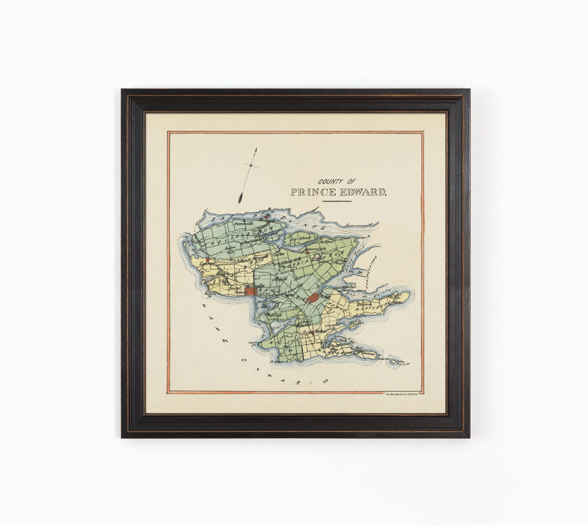
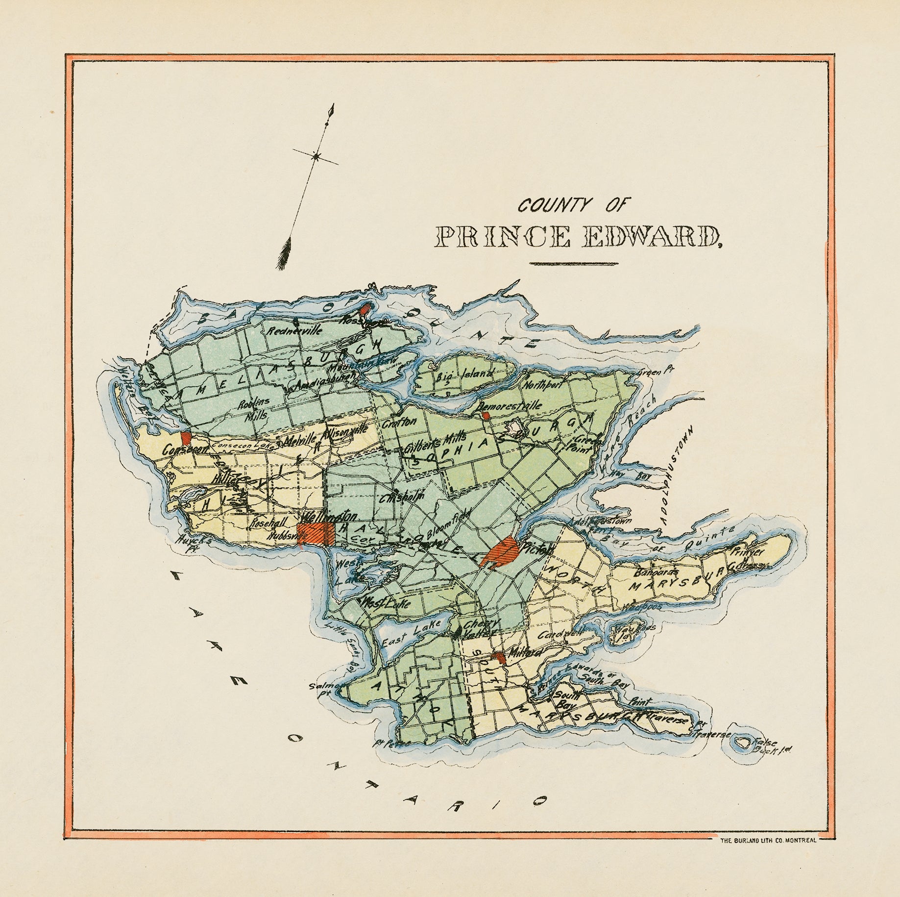
Detailed early map of Prince Edward County depicting lots and concessions, electoral boundary district, native reserves, roads, and railroads etc. This is a classic hand-drawn map from the Burland Lithograph Company, based out Montreal. Looks great printed in smaller sizes, as well as a focal point for larger rooms.
(Please refer to FAQ's for more info and pictures.)
- Paper-Hahnemuhle Archival, heavyweight and thick 240g 100% cellulose, warm white art paper with a smooth matte surface. Perfect for framing.
- Canvas-Gallery wrapped using heavyweight 400g, archival canvas. It's protected with a satin varnish, and stretched around a 1.5 inch pine wood frame, ready to hang. (No exterior frame)