


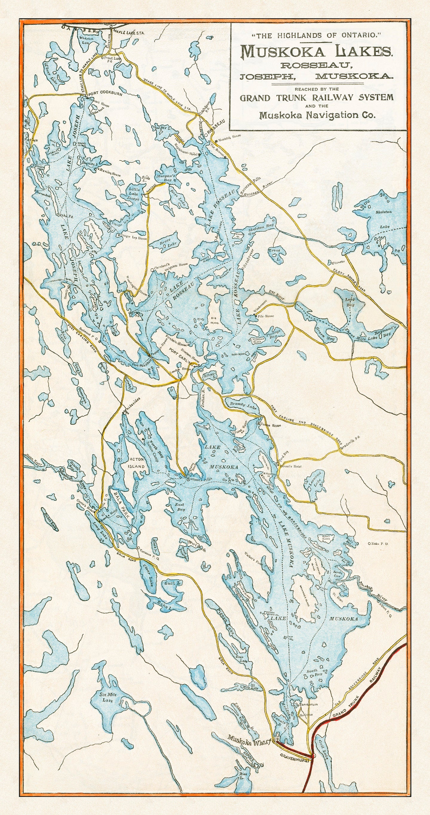

This hand-drawn map, originally from the 1890's was used by the Grand Trunk Railway Company to promote Ontario's Highland focusing on the Muskoka Lakes district. The geography of Lake Muskoka, Lake Rosseau, and Lake Joseph feature prominently on this map and it also includes steamship routes of the Muskoka Navigation Company, which was the primary mode of transportation once travelers arrived at the region.
After the railways were built, the GTR launched a significant promotional campaign to bring vacationers, primarily from the Eastern seaboard of the United States and the UK, to enjoy the region. The marketing materials often used very romantic language to describe the natural beauty of the region.
To the artistic eye of the traveler who hungers after tidbits of forest vistas, and thirsts for glimpses of far-off and half-concealed islands, Muskoka is a thing of beauty and a joy not soon to be forgotten.
(Please refer to FAQ's for more info and pictures.)
- Paper-Hahnemuhle Archival, heavyweight and thick 240g 100% cellulose, warm white art paper with a smooth matte surface. Perfect for framing.
- Canvas-Gallery wrapped using heavyweight 400g, archival canvas. It's protected with a satin varnish, and stretched around a 1.5 inch pine wood frame, ready to hang. (No exterior frame)