


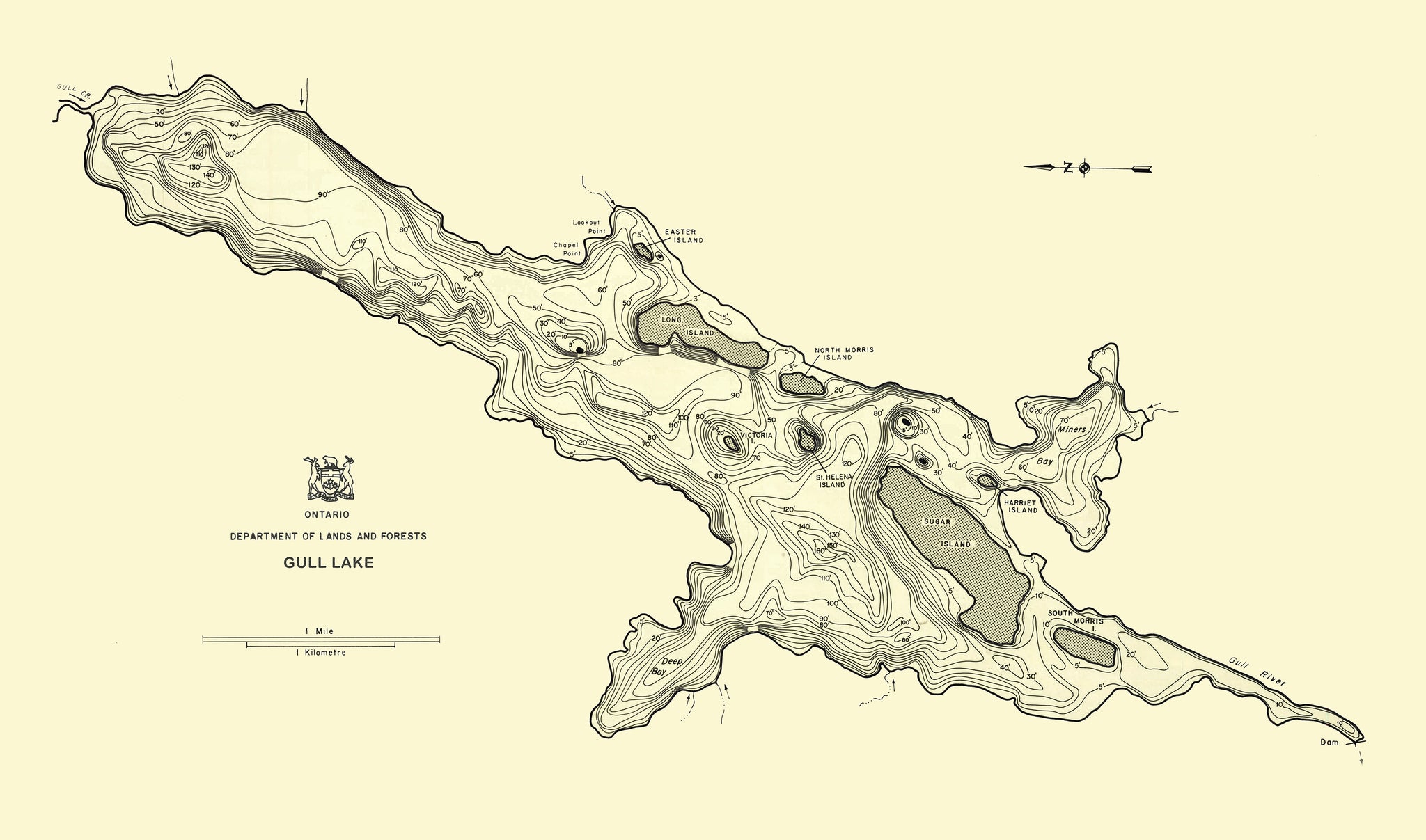
This map of Gull Lake in the Haliburton region is from a series of bathymetric maps produced by the Ontario Ministry of Natural Resources. The map was created in the early 1960s and showcases a high level of detail and precision demonstrated by the cartographer(s). The contours of the shoreline and lake depth, as well as hand-drawn features, are well captured. The result is a beautifully simple and organic illustration of this central Ontario gem.
(Please refer to FAQ's for more info, shipping details and more pictures on product options.)
- Paper-Hahnemuhle Archival, heavyweight and thick 240g 100% cellulose, warm white art paper with a smooth matte surface. Perfect for framing.
- Canvas-Gallery wrapped using heavyweight 400g, archival canvas. It's protected with a satin varnish, and stretched around a 1.5 inch pine wood frame, ready to hang. (No exterior frame)