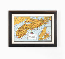
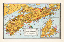
Some might describe it as kitschy, but we think this animated map of Nova Scotia is FUN! The series is from the mid-1920's and was part of an illustrated Atlas of Canada, created on behalf of the very official sounding, Department of Interior.
The map features various "sporting" adventures in the geographic regions of Nova Scotia, as well as farming, agriculture, natural resources, and popular modes of transportation of the time.
This map art is part of a series. You can view the Ontario, British Columbia and Alberta versions in the collection.
(Please refer to FAQ's for more info and pictures.)
- Paper-Hahnemuhle Archival, heavyweight and thick 240g 100% cellulose, warm white art paper with a smooth matte surface. Perfect for framing.
- Canvas-Gallery wrapped using heavyweight 400g, archival canvas. It's protected with a satin varnish, and stretched around a 1.5 inch pine wood frame, ready to hang. (No exterior frame)


