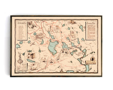
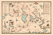
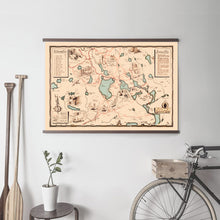
A unique illustrated map of a beautiful slice of Ontario that is one of the oldest forest & wildlife preserves in the province. The area about 20-minutes Northeast of Huntsville has long been a favorite spot for locals and tourists to enjoy the natural beauty of Ontario shield country.
In the '20s, the Limberlost Lodge was pioneered by the Hill family and was an impressive and relevant example of eco-tourism in a time before such a term existed. The map depicts the 10,000 acres of the reserve and many of the 70+km of trail systems and points of interest that still exist today, as well as charming illustrations of the various wildlife present in the reserve.
A portion of the proceeds of this map will be donated to benefit the Limberlost Forest & Wildlife Preserve.
(Please refer to FAQ's for more info and pictures.)
- Paper-Hahnemuhle Archival, heavyweight and thick 240g 100% cellulose, warm white art paper with a smooth matte surface. Perfect for framing.
- Canvas-Gallery wrapped using heavyweight 400g, archival canvas. It's protected with a satin varnish, and stretched around a 1.5 inch pine wood frame, ready to hang. (No exterior frame)
Have something specific in mind but don't see it in the available options? We can facilitate almost any request, just drop us a line to info@grandtrunktrading.co with details and any appropriate links to reference and we'll get back to you!


